Tea Room Minami Yonban Classic (British embassy villa memorial park)
Eat & Drink
We use cookies on this site to enhance your user experience. If you continue to browse, you accept the use of cookies on our site. See our cookis policy for more information.

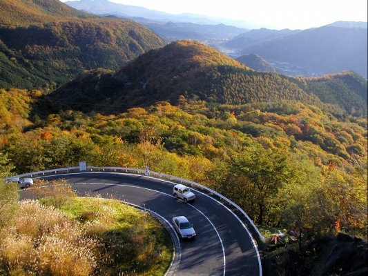
Irohazaka is a pair of winding roads (ascending and descending) connecting Nikko-city and the mountainous Lake Chuzenji area. The roads are named after the 48 syllables of the Japanese alphabet (kana) as they contain 48 hairpin turns while rising and falling 440 metres in elevation. The best viewing spot is the Akechidaira observatory on the descending road. The picturesque landscape is known as the most beautiful place to celebrate autumn leaves in Nikko, and it is well worth putting up with the traffic on the roads at this popular time.
| Address | Nikko-shi, Tochigi |
|---|---|
| Telephone Number | 0288-22-1525 |
| Website | https://www.visitnikko.jp/en/spots/irohazaka-slope/ |
| Map Code | 367 243 314*87 |
The Nikko area, in the northwestern part of the prefecture, is particularly mountainous. In the midst of the rich nature, including the 2,486-meter-high volcano Mt. Nantai, Lake Chuzenji, and Kegon Falls, there are numerous shrines and temples that are registered as UNESCO Cultural Heritage sites. From Kinugawa Onsen to Kawaji Onsen, hot springs can also be found throughout the area. There are a wide range of outdoor activities to enjoy as well, such as stand-up paddleboarding in the summer and snowshoeing in the winter.